Now this is cool.
I’ve been looking for a tool to display Canadian airspace in real time. Some of the google earth kml files that users have produced have been of poor quality.
Not anymore.
Using a free database of aeronautical information, Global Imaging have created a kml file that accesses this DB in real time (as you turn individual items on and off).
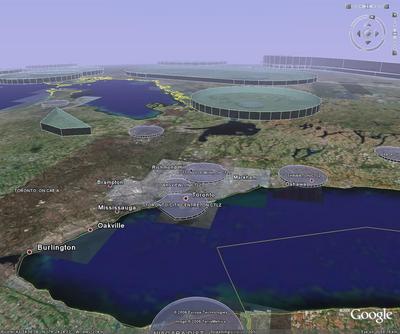
I was able to turn on only select control zones and terminal control areas for the toronto area that I fly in.

You can download the kmz file for Google Earth here.