I went flying on Saturday with a coworker. The weather was perfect! We headed up north to Barrie and could see the Toronto skyline. The visibility was at least 80kms. I guess that’s what you get when you combine a cold front with a high pressure system.
I’ve been working hard on a project and would like some users who would be willing to beta test some of its features.
There are essentially two main parts to this project. The first is flight planning, and the second is visualizing this flight plan.
I’m going to need some people (hopefully across Canada) who will be able to sanity check some data and offer feedback to how the system can be improved.
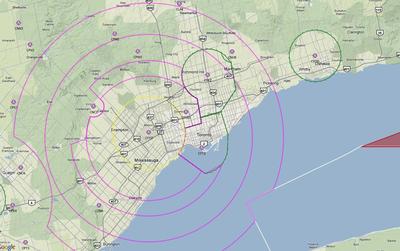
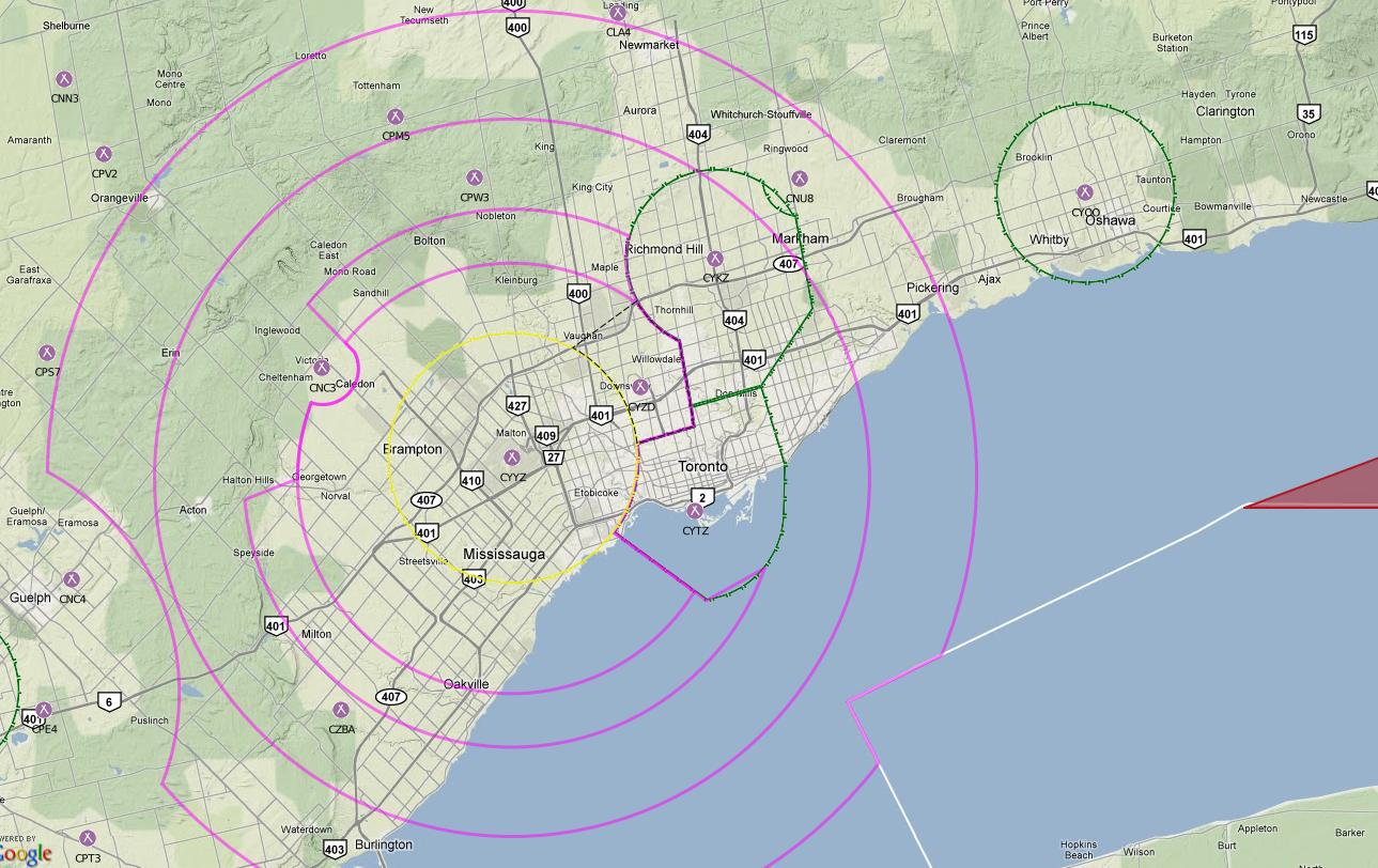
For example, here is a screen shot of a map I put together for the airspace around Toronto. Click to view a larger version.
I’m soliciting feedback from pilots on how you would like to see the data presented. If you are interested in providing feedback and to be on the beta list of users please feel free to comment on this post with your request.
You must leave an e-mail address (don’t worry, it wont be posted on the site) when you fill out the comment form to be eligible.
Blake,
I’ll have a look at it for you. I have been looking around for something for a while. nav Monster does a fair job, but I was looking for something more comprehensive that would have the capability of filing flight plans.
This looks like a real nice tool. If I did flight planning more often (or at all), I’d use it.
Blake,
I’d be happy to take a look at a new flight planning tool. There are many good ones out there, but not many that are that useful for the type of flying that I do, which seems to be similar to yours.
I will test it out for you Blake. I’m doing my cross country flight within the first 2 weeks of October and this app will help.
Blake,
I’d love to test out the tool, I am trying to put together a web based software that will generate flight plans for my company. Would like to take a look at this and help out where I could.