Day and Night
I was able to get in two x-country flights this week. The first flight was to Owen Sound.
During my flight planning, I noticed the NavCanada website was down. I thought to my self.. great, I’m going to be on hold for ever when I call up London FIC.
Had to wait maybe 10 seconds before I got a flight service specialist. I got a weather briefing, which included upper winds, and NOTAMs and started the planning process.
The FD for both Wiarton and Toronto were showing 25KT winds at the 3000′ level and 6000′ level. I ended up planning to fly at 6500′ there and 5500′ on the way back. Since it didn’t really matter because the winds were just as strong at 3000′ than they were at 6000′.

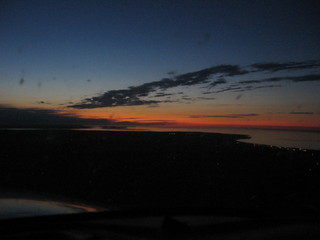
Flying into the sunset with Nottawasaga Bay to the north
As I climbed up to 6500′ I can see my ground speed on the GPS dropping.. 90KT…85KT.. 70KT!! Brutal. Guess the upper winds were wrong! as the winds were clearly a lot slower at 3000′. I descended back down to 3500′ and saw a more “respectable” 90KT on the ground speed.
(I can hear the terminal controller chuckling when I said I wanted to descend down to 3500′ because the winds. My poor little 172 chugging along at 70KTs on his radar)
The airport was really easy to find at night. It’s beacon was bright enough to be able to discern it from other light pollution.
My original plan was to do a touch and go. But I ended up floating down the runway longer than I was comfortable with. So I stopped and backtracked. This was probably the hilliest runway I’ve ever landed on.
The flight on the way back was uneventful, except for the 130KT ground speed on the way back. I was able to find Buttonville easier this time around. I think I’m getting used to approaching it from the west at night now.

GPS Showing 127KT ground speed
My second flight was to Tyendinaga on a Mohawk Indian reserve. It’s just east of Trenton. The weather was beautiful and smooth. My route took me over Oshawa and CFB Trenton. I was able to take some nice snaps of the aircraft parked at the base.
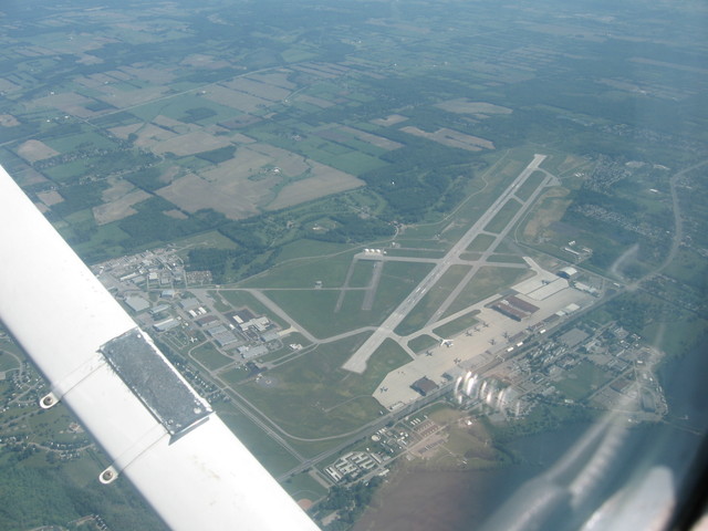
CFB Trenton
Thinking back, I think this is the first time I’ve ever joined an uncontrolled airport straight in to the downwind. Previously, I’ve always flown overhead.
On the way back I played the “I’m lost” game. This is where I will use navaids to estimate my location on a map. In this particular instance I used the Oshawa (OO) NDB and the Coehill (VIE) VOR.
First, I used the VOR to figure out which radial I was on. After tuning and identifying the VOR, I turned the OBS knob until I got a from flag and the CDI was centered. Approx the 240° Radial.
Next, I used the Oshawa NDB and the ADF to give me a bearing to the station. It was 10° to the right.
I took a look at my map and drew a line representing the 240° radial from the Coehill VOR. Now I know I am someplace on that line. Then I took my heading (270°) added 10°, then took the reciprocal (100°). I then drew a line from the Oshawa NDB south east, approx 100° until it intersected the 240° radial. That was my approximate location.
Fun!