How to use NavCanada’s Operational Information System
NavCanada’s Operational Information System (OIS) outlines all of the traffic flow-related information for Canada and most US centres. It offers the following information that can be used by smaller operations, flight dispatches, and IFR GA pilots on:
- Ground Delays
- Ground Stops
- Airspace Flow Programs
- Outages (Runway closures, ILS serviceabilities, etc..)
- Flight Checks by NavCanada
It also displays which runways are in use at airports and at what capacity (measured in aircraft arrivals/departure per hour).
Lets take a look at the first grid: “Runway Configurations”:
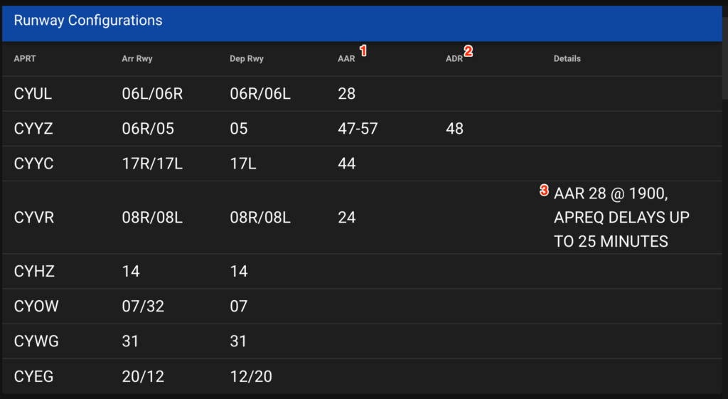
This grid displays which runways are currently used for arrival and departures. The capacity of the airport and the number of aircraft that it can support for arrivals and departures. The last column will outline any future changes or more details about the state of the airport.
If you take a look at Note 3 in the diagram, you will notice that starting at 1900Z, YVR will be implementing an approval request (APREQ) for flights arriving in Vancouver. APREQs are usually implemented when they need to slow traffic down into an airport without implementing a ground stop (GS) or ground delay program (GDP) at the departure airport. An APREQ might come in the form of a specific clearance time when asking for your IFR clearance to depart. (“Void if not airborne by”).
Ground Delay Programs (GDP) are usually implemented when the projected traffic levels to an airport exceed its current capacity.

In the example above, SFO’s capacity has been reduced due to weather. Any flights from Calgary, Edmonton, or Vancouver may be delayed between 150-243 minutes due to weather and wind. Clicking on the advisory number displays this information:
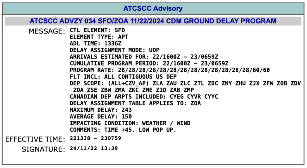
A Ground Stop (GS) is usually implemented when the capacity of an airport is projected to be zero. It can also be implemented when the projected capacity is only reduced for a short period of time (for example: a quick runway sweep for safety reasons).

Clicking on the advisory number will give us more detail:
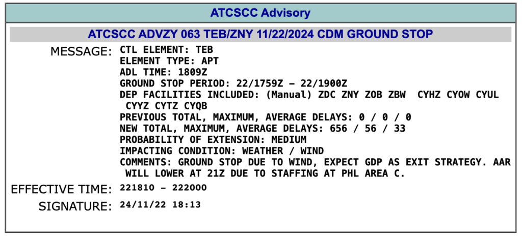
Not only is this ground stop to Teterboro due to weather, but also because ATC staffing will be lower than required in the next 3 hours.
The next grid displays any restrictions into a specific centre, FIR, or terminal.

In this example, any traffic departing Gander and Moncton FIRs to the Boston FIR will not be able to climb higher than FL270.
Unfortunately I don’t have examples for the next two grids. Routes and Cancelled Initiatives.

The routes section will list any reroutes by the FAA into Canadian airspace due to weather, staffing, etc..
Cancelled Initiatives will list any traffic management initiatives that were in place in the past 30 min but have since been cancelled.
Outages and Runway Closures will list runway and equipment closures that will affect Canadian airspace.

Flight Checks are when NavCanada sends their CRJ to perform functional tests of equipment at airports. Such as testing the ILS system or other navigation equipment. Here is an example of what those checks look like (Here at Montreal)
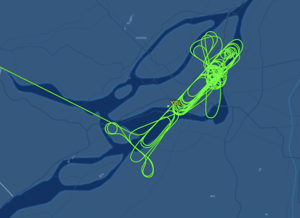

In this example. NVC101 will be performing routine checks on the ILS system for runway 08L.
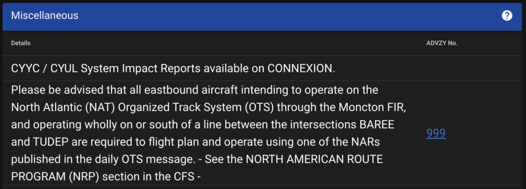
And finally the Miscellaneous section offers any other information that doesn’t fall into the previous grids that would affect flow/traffic management in Canadian airspace.
If you require more detail on each grid section, there is a “help” icon in the top right hand corner of the grid that will provide you more details.
