I haven’t been flying in a while due to either being sick, or this thing called ‘the cottage’.
In either case, I was able to make it up last night. I normally like to visit a new airport each time I go up, but tonight it was a trip to Collingwood, which was the second airport I ever visited as a licensed pilot.
If you were to fly direct to Collingwood (CNY3) from Buttonville (CYKZ), it would take you right over CYR502. It’s airspace that is restricted over the firing range at CFB Bordon. I wonder at what altitude this airspace its restricted to.
– I checked in the CFS. Not listed.
– I checked the VNC, the airspace is marked and says its capped to 7000′.
– The VTA also shows it capped to 7000′.
I wonder why its not in the CFS?
In anycase, I planned on flying my route direct Barrie/Springwater which means I will be flying through CYA509(P). I checked the NOTAMs and this airspace was active today. The NOTAM listed the airspace was capped at 4500′, which was my planned altitude. I decided this wasn’t an issue.
In the end my flight plan was the following:
CYKZ CNA3 CNY3 (00:10) CNY3 YMS CYKZ
This is one of those situations I wish I brought my camera as so many interesting things happened on this flight.
As I was dealing with paperwork at dispatch, I saw a column of rising smoke near the departure end of the active runway (today it was 15). I figured it was just a car fire on highway 407. When I departed I took a glance, and it was an actual building that was on fire. Although I wouldn’t be flying through the actual column, I could smell the smoke pretty strongly as I made my right turn northbound.
I tuned to the Cookstown frequency early to see if there was any activity going on in the drop zone. The NOTAM was saying that it was active, so I was expecting to hear something. Yup, I heard an aircraft that was launching jumpers at 4500′. I called up as a courtesy to let them know that I will be passing by their area to the east (avoiding their zone) at 4500′. The reply I got was a strong reminder that the paradrop zone was active.
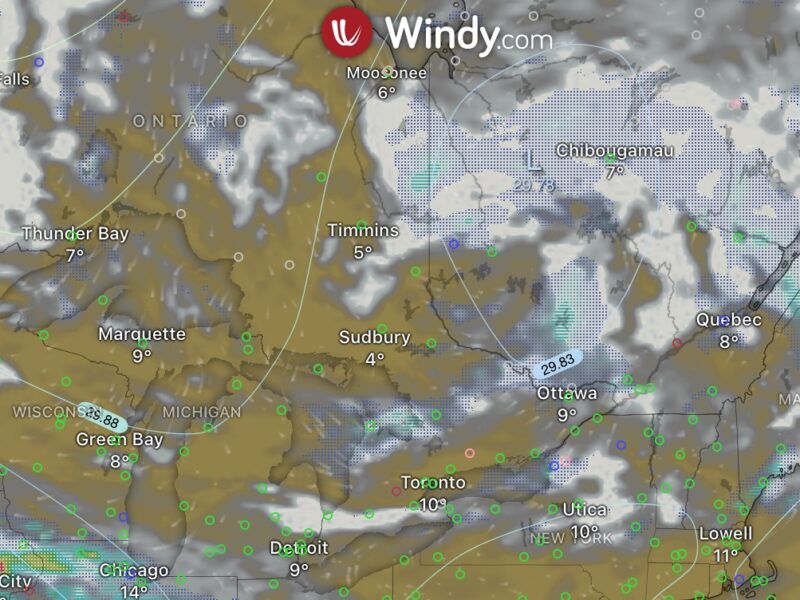
As I made my way to Collingwood, I decided to call up London FIC to get the latest winds at Bordon. I started planning my approach and I wanted to predict what the active runway at Collingwood would be. The winds at Bordon were coming from 330. Interesting how 40 miles or so, and the wind direction can change by 180°. So I planned for runway 31. I made my necessary calls, overflew the field and double checking the windsock, then joining a mid-left downwind for 31.
I turn on final and BAM! Pounded by the setting sun right in my field of vision. Hmm.. this situation could be dangerous. When you combine a slow moving prop (as is the case on final approach) and the sun, you can get into a situation where the sun light is “strobing”. It’s highly distracting. Combined this with the fact that the windscreen is scratched and you get into a situation with reduced visibility.
It was extremely hard to judge height. So I kept a close eye on the altimiter and decided that my approach would be high. The runway length was 5000′, which is plenty of room to land longer than normal.
My approach was stable, yet still really uncomfortable. I didn’t overshoot because I knew I would make the field and that as long as I kept the decent profile the way it is, I would land safely.
So my return leg had me going over the Mans VORTAC, then direct to Buttonville. I dialed up the VOR to the proper frequency and tried to ident the station. Nothing. Hmm.. I dialed up the Simcoe VOR and tried to ident. Nothing. Either two very important VORs are broken, or the volume knob on my VOR receiver is busted. I assume the latter and retune the instrument to the Mans VOR and figure out what radial I’m on, ensuring that the “TO” flag is present as I want to fly to the VOR.
I track the radial inbound to the station and notice my entry into the cone of confusion. I look down and see the VOR – “Hello Miss Witch! I see your hat is white today!” I say to my self as I wave down at the radio array in the fading light.
I’m getting more comfortable dealing with radio navigation.
I report over Aurora to Buttonville tower and he tells me to report a 3 mile final for 15. But for whatever reason, I decided to set my self up for a left base for 15 (this is 10 miles out!).
Buttonville is one of the hardest airports to find at night. So I was taking a route that I know would guarantee me finding the airport. So when the controller told me that I was too far east of the arrival path for 15 and to start turning South, thats when the light bulb over my head illuminated.
Why the hell don’t I use the localizer on 15 to line me up with the runway?! Ugh. I dial in the frequency my VOR receiver (which is a convient 111.1 Mhz) and turn the obs knob to 150. Yup, the needle is fully deflected to the right.
So I continue flying south, glancing back and forth between the needle and outside trying to get any indication where the airport might be. Specifically, I’m looking for the strobes (or the RILs, Runway Identification Lights). I found the airport before the needle came alive on the localizer. I let ATC know that I have the airport and sight.
Although I departed at 8:20pm, I wasn’t able to log more than 0.3 hours of night.

