Cool and Interesting Airports To Checkout in 2025
In no particular order here is what I think are some of the most interesting airports in Canada and why. If you have a cool or interesting airport you’d like to add to this list, email me or send me a note on Bluesky.
Orillia Rama Regional (CNJ4) & Rockcliffe Airport (CYRO)
Why: Both airports allow you to taxi into or out of the water.
Submitted By: Marc Charron
Airplanes can land and take off on both land and water. But some (called amphibians) can do both at the same time. With a lake near by both airports, it’s fun to watch these birds land gracefully on the water and then taxi (under their own power or with a tug) onto the apron to park.

Pelee Island (CYPT)
Why: Canada’s most southern airport.
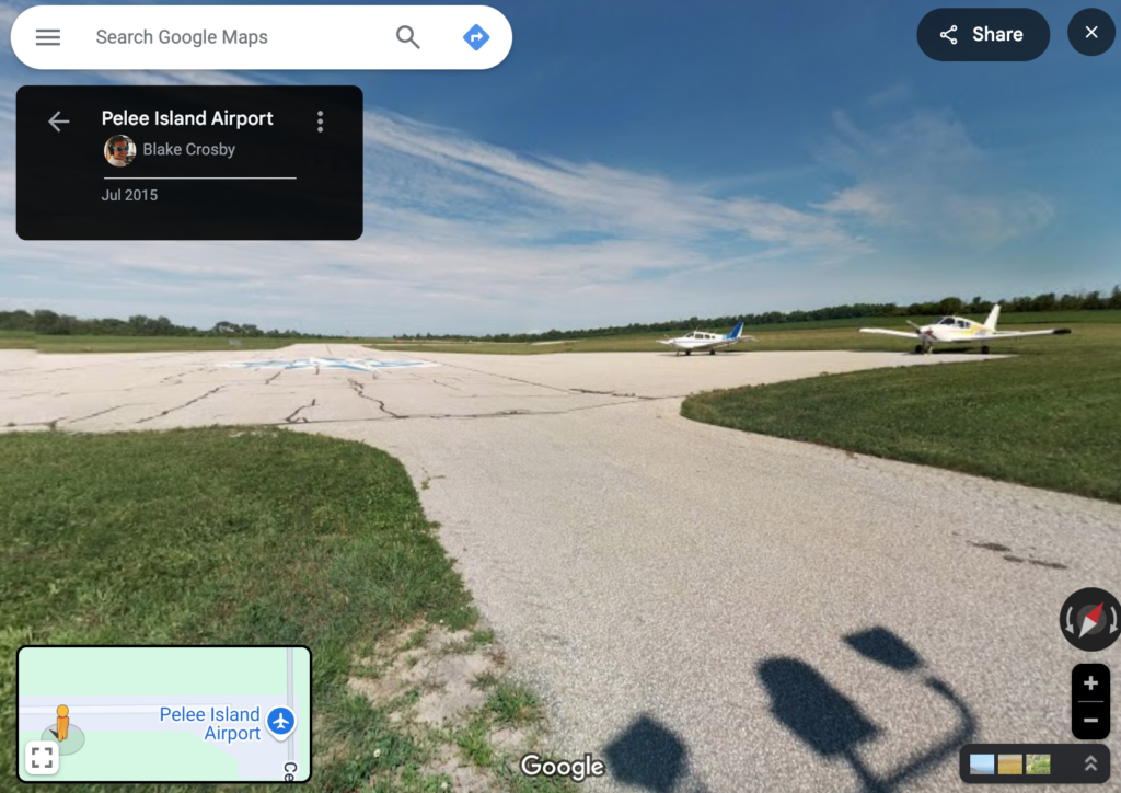
Located at latitude N41.778, the Pelee Island airport is situated on an Island in Lake Erie, 5.1 nautical miles north of the US/Canada Border. Yet it is actually further south than Chicago’s O’Hare Airport! While you’re there be sure to check out the Pelee Island Winery.
Fun fact: The only Google Street View of the airport, was submitted by me, back in 2015.

St. Pierre Airport (LFVP)
Why: So you can fly to France in only 41nm from Winterland, Airport (CCC2)
While technically not in Canada (so bring your passport) yet still inside Canada’s ADIZ, I’ll give the St. Pierre Airport a pass. Located on the island of St. Pierre, France, a French overseas territory just off the coast of Newfoundland, Canada. Bring your euros and enjoy a few days on the islands of St. Pierre et Miquelon (LFVM)

Gander International Airport (CYQX)
Why: Canada’s easternmost airport.
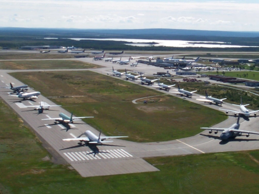
Gander is a special airport as it is used as a hopping off point for single engine airplanes to continue eastward over the Atlantic to Europe. It also played a pivotal role accepting aircraft during the events of 9/11 when the airspace in the USA was closed. Lots of history here.

Scobey Border Station (CKK3), Ross Airport (CEP4), Whetstone Airport (CEQ4)
Why: The runway is bisected by the US/Canada border.
All three of these airports are grass strips where the US/Canada border runs right along the centreline. Half of your airplane will be in Canada while the other half will be in the United states as you perform your landing rollout. No passport required. (*So long as you don’t cross into the wrong side after landing).
There are two other airports: Avey Field State Airport & International Peace Garden Airport that technically fall in this category. However, they don’t have Canadian airport identifiers and are “technically” in the United States.
Sad Fact: The only airport in this series with a paved runway (Piney Pinecreek Border Airport) closed as of December 27, 2024.

Beaver Creek Airport (CYXQ)
Why: Canada’s most western airport.
The gravel strip was built back in 1960 by Jack Stalberg, a dedicated aviator. Today, its mostly used as an airport of entry to/from Alaksa, USA and Yukon, Can.

Vancouver Harbour Water Airport (CYHC)
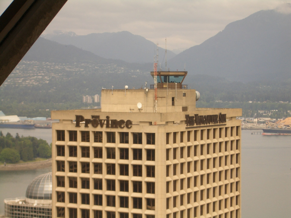
Why: Highest air traffic control tower in the world (at 466′ above sea level).
The control tower for this water aerodrome is located atop of a skyscraper in downtown Vancouver. It is the busiest seaplane base in Canada, so no wheels allowed when checking out this airport.

Alert (Military) Airport (CYLT)
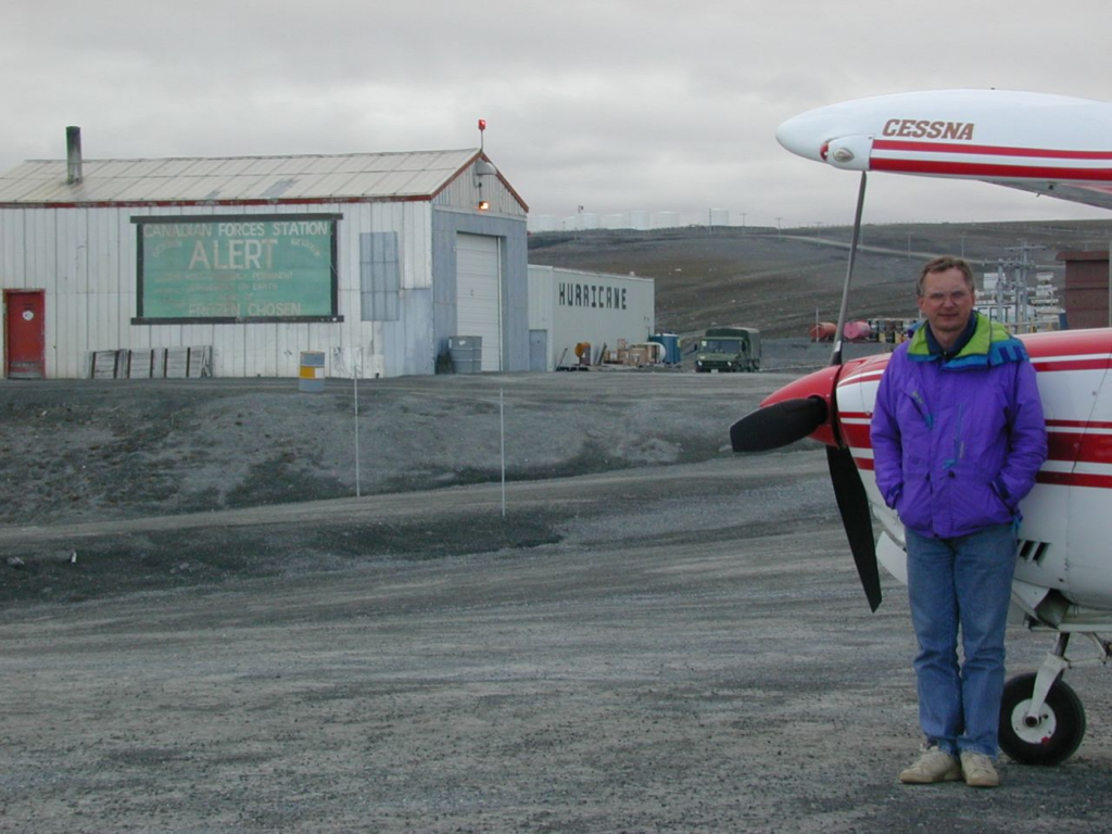
Why: Canada’s most northern airport
Located at latitude N82.52 in Canada’s northern domestic airspace. It is operated by Canada’s Department of Defence and is located just 720nm south of the true north pole. Good luck visiting Alert as the nearest airport is located 260nm away in Eureka, Nunavut (CYEU).

