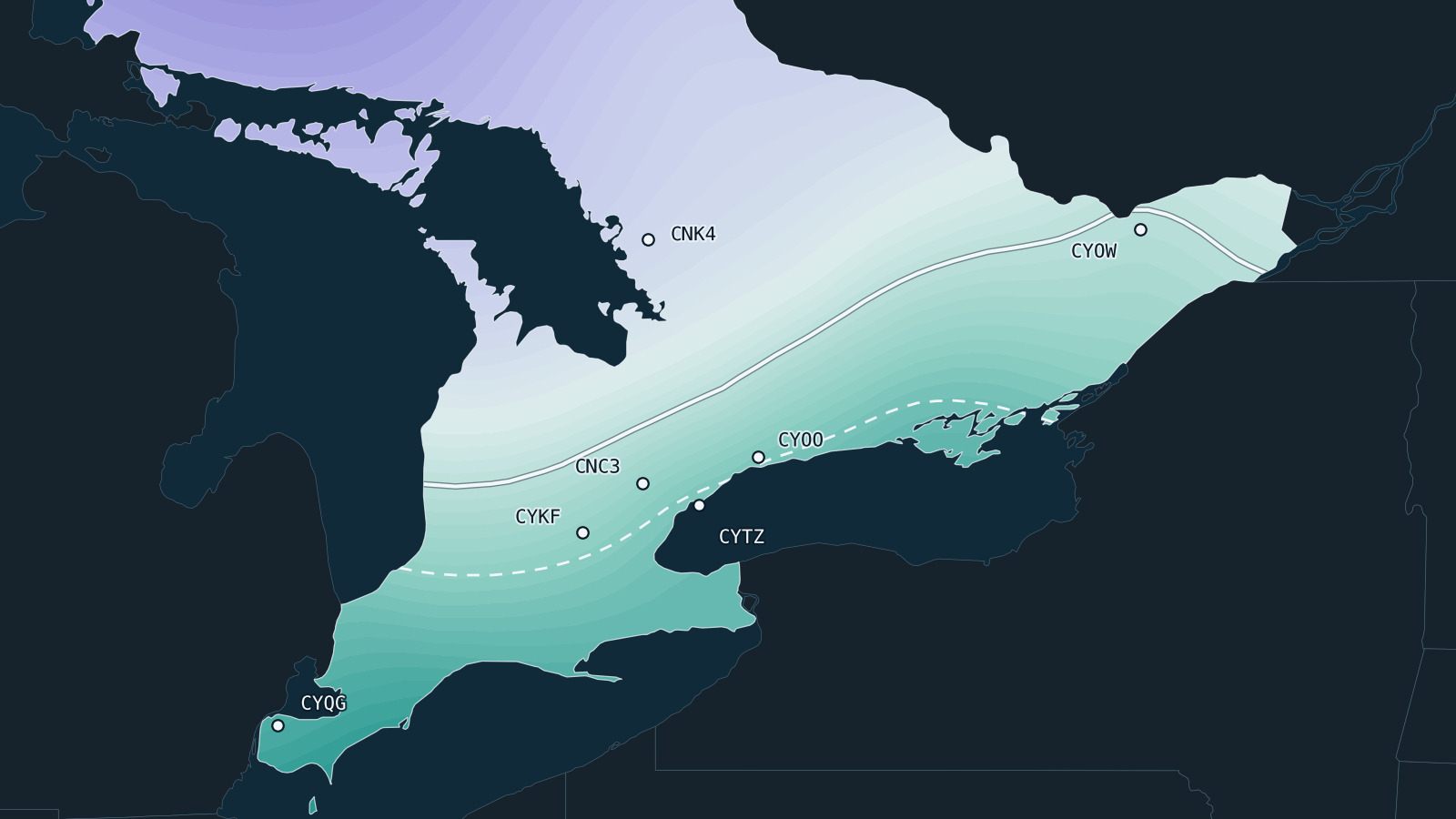
Winter 2026–27 flying outlook for Southern Ontario
Expect a milder winter with less snow, but not necessarily more VFR days. February has been the best month for VFR at all seven airports, and December the most likely to disappoint.
A lot of you have been asking me what the weather will be like this winter considering all of the noise around this “record breaking” El Niňo.
So I decided to look at 7 airports across Southern Ontario and tried to answer the following questions:
- Will temperatures be warmer than normal?
- Will the type of precipitation be more rain than snow?
- Will this year include more or less VFR flying days than normal?
Data is compiled for the months of December – February.
I decided to compare two products: Environment Canada’s CanSIPS and ECMWF SEAS5. Here is what I discovered.
If you want to jump straight to the data. You can do so here: fly.blakecrosby.com/winter26-27/
Temperature
Both models agree that we will experience higher than normal temperatures this winter.
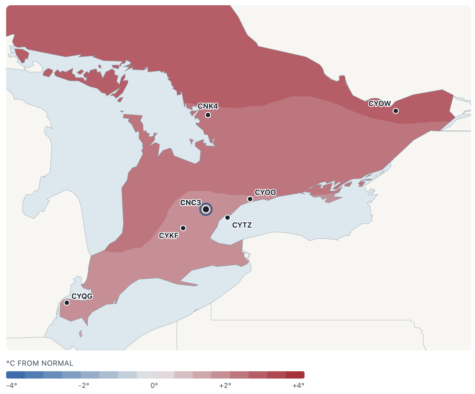
However, not so much higher that temperatures (on average) will be above freezing. Toronto will be close though, with a likely mean temperature of -0.4C this winter.
What This Means for Flying
Low ceilings and fog. Mild, moist air moving over cold ground or snow can form stratus and fog. In the last two strong El Niño Decembers, low ceilings ran 75–158% more often than usual.
Icing/Freezing Rain. As temperatures hover closer to 0C, icing at altitude can be a factor. Although not an unusual problem during winter flying. The freezing level can be lower during El Niňo years.
Precipitation Type (Rain or Snow)
The precipitation line (50% rain / 50% snow) will likely move further north this winter.
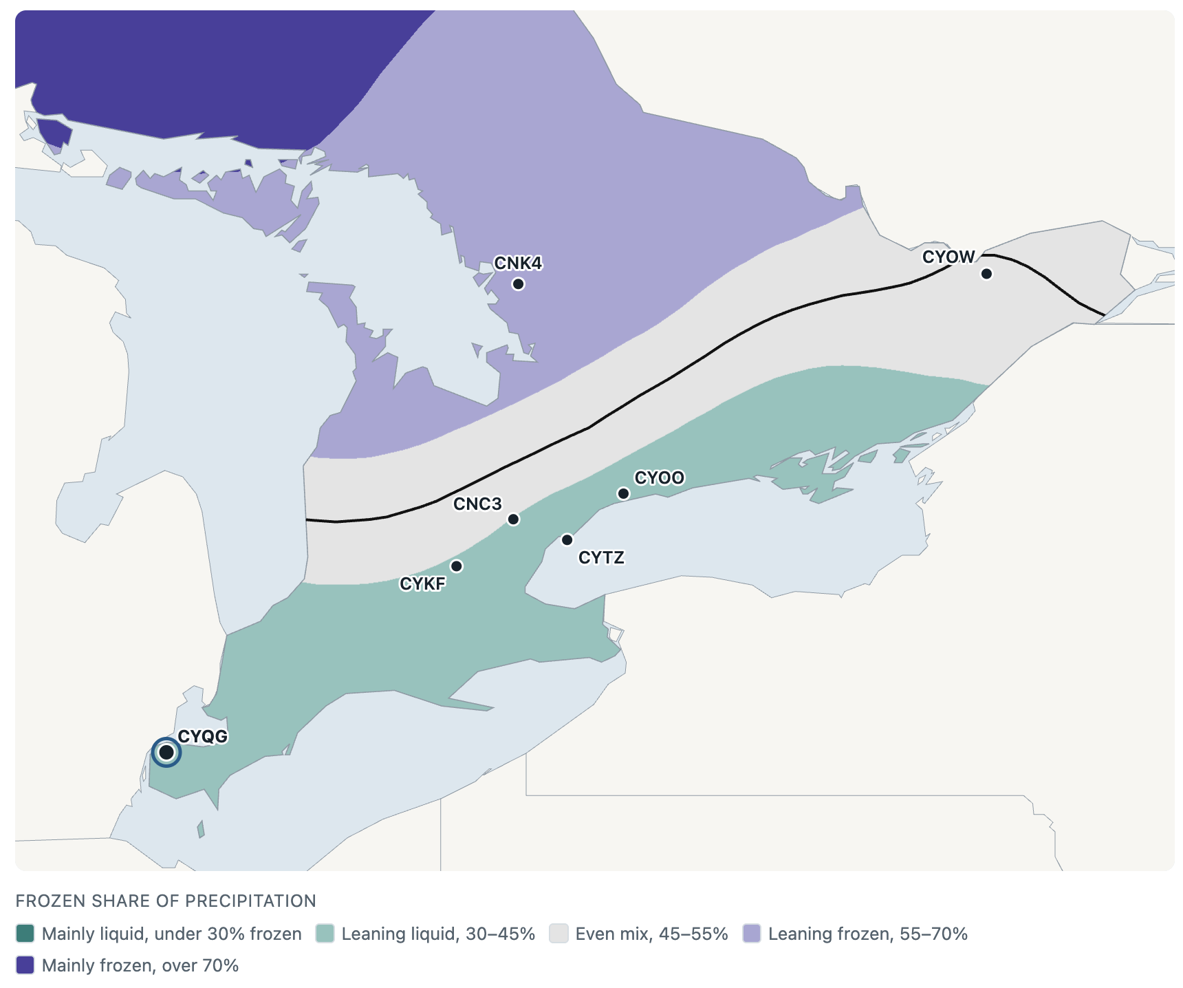
The majority of the airports in and around the GTA will likely experience frozen precipitation 45% of the time or less. This means, if there is precipitation, the majority of it will fall as liquid (below the black line).
What This Means For Flying
Runways. Expect rain, slush, wet snow and overnight refreezing, sometimes all in one week.
VFR Flying Days
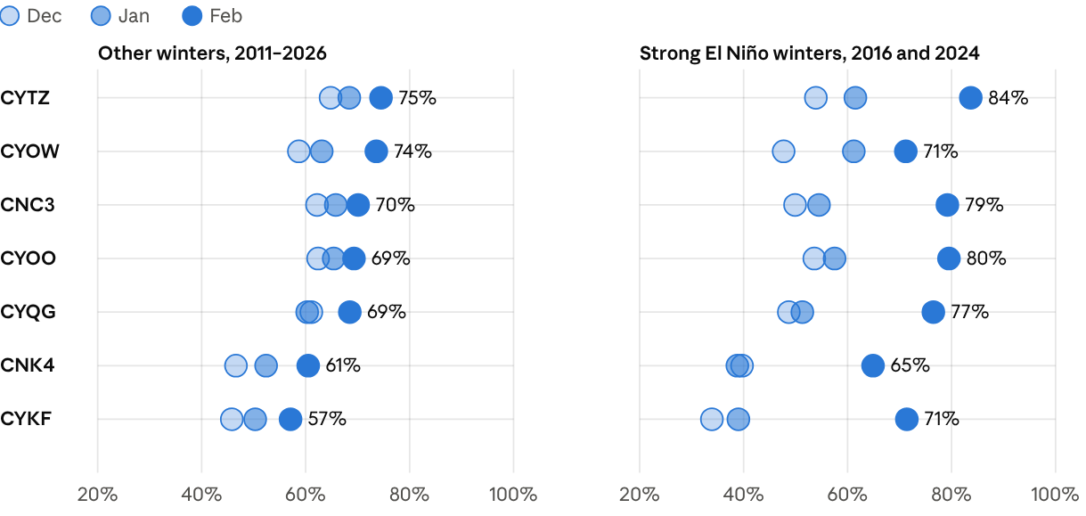
Looking back at past conditions (no forecast models here). The number of daytime hours where the visibility was above 5 sm and ceilings above 3000′ AGL started off worse at the season but got much better in February during El Niňo years.
Where as the during non El Niňo years, the number of VFR hour per day remained roughly the same all season long. With the exception of Ottawa and Perry Sound/Muskoka.
What This Means For Flying
Don’t get discouraged at the start of the season (Dec-Jan). Take this time to study and write any necessary written exams instead. Save the flying for February.
Conclusion
None of the predictions above take into account lake effect precipitation. I’m also not a meteorologist. This is just how I interpreted the data.