What’s Keeping Me Busy
My day job is a System Administrator at a broadcasting company. This gives me the advantage of being handy with computers.
This advantage has lead me to pair up with a buddy to work on a project that will hopefully be revealed soon. One thing I did want to show off, that i’m particularly proud of, is the mapping engine that I’ve been working on for this application.
One of the frustrating things is that NavCanada does not publish digital formats of their charts and CFS. This means that a website like skyvector.com cannot exist for Canadian Airspace.
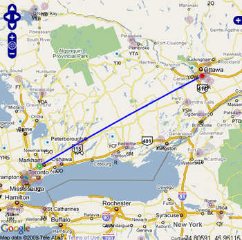
A good compromise is to overlay aeronautical information on top of google (or Yahoo) maps. As you can see in the above screen shot (click to get a larger photo) there is some information available:
– NDBs
– VORs
– There is a track from CYKZ to CYOW (the blue line)
If you wanted, you can also overlay Victor airways (gets kinda messy):
Although you can’t use this for navigation, it will be a good tool for planning purposes. As well, it merges the aviation world with the car world. By that I mean you can get a good idea if an airway passes over your house, or where exactly that NDB antenna is.


I couldn’t agree more, its amazing how archaic most of the information made available to pilots is. I cant believe that it took until 2009 for Nav to finally publish a map that shows VFR pilots where the heavy arrival routes into YYZ are!